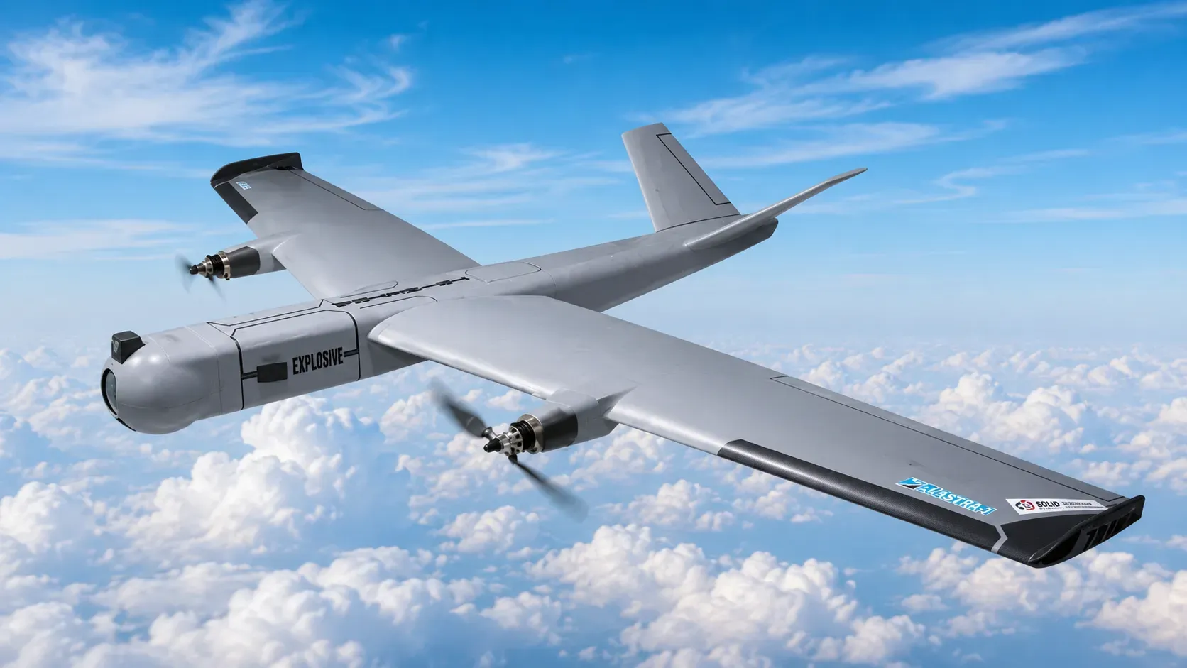
India's civilian drone framework now depends heavily on one operational tool: the DigitalSky drone airspace zone map. Under Rule 19 of the Drone Rules 2021, operators must verify whether a flight location falls inside a green, yellow, or red zone before takeoff begins. The map became more important after 3 July 2025. DGCA migrated drone registration and certification workflows to eGCA on that date. Airspace permissions and the airspace map itself remained on DigitalSky (DGCA Public Notice, 3 July 2025). Recent enforcement actions linked to civilian drone misuse involve operators who either ignored the map or misunderstood altitude restrictions near airports and sensitive installations. Under current DGCA rules, green zones generally allow flights up to 400 feet or 120 metres above ground level (AGL) without prior permission. Yellow and red zones require additional approvals or prohibit operations entirely (Ministry of Civil Aviation, 24 September 2021).
What India's drone airspace zone map actually is
India introduced its national drone airspace map on 24 September 2021 alongside the implementation phase of the Drone Rules 2021. The Ministry of Civil Aviation stated that the map would divide Indian airspace into red, yellow, and green zones. The framework was designed to simplify compliance for civilian operators (Ministry of Civil Aviation, 24 September 2021). The map was developed with mapping support from MapmyIndia and platform infrastructure linked to DigitalSky.
The map serves two operational purposes. First, it allows drone operators to verify whether a flight location requires permission before takeoff. Second, it enables authorities to restrict airspace in real time during temporary security events through Rule 24(2) declarations and NOTAM-based overlays.
The importance of the map increased after the Bharatiya Vayuyan Adhiniyam 2024 came into force in January 2025, replacing the Aircraft Act 1934 as India's principal aviation legislation. The updated framework strengthened the legal basis for digital compliance systems, including NPNT enforcement and geofenced permission workflows (Parliament of India, 2024).
The 3 July 2025 operational split between eGCA and DigitalSky also changed how operators interact with the ecosystem. Drone registration, type certification, UIN issuance, and Remote Pilot Certificate workflows moved into eGCA. DigitalSky retained responsibility for:
- Airspace validation
- Flight permissions
- NPNT authorisation
- Zone classification
- Temporary flight restrictions
First-time operators often assume eGCA hosts the live airspace map. It does not. The DGCA airspace map remains on DigitalSky, and any operator searching eGCA for zone information will not find it.

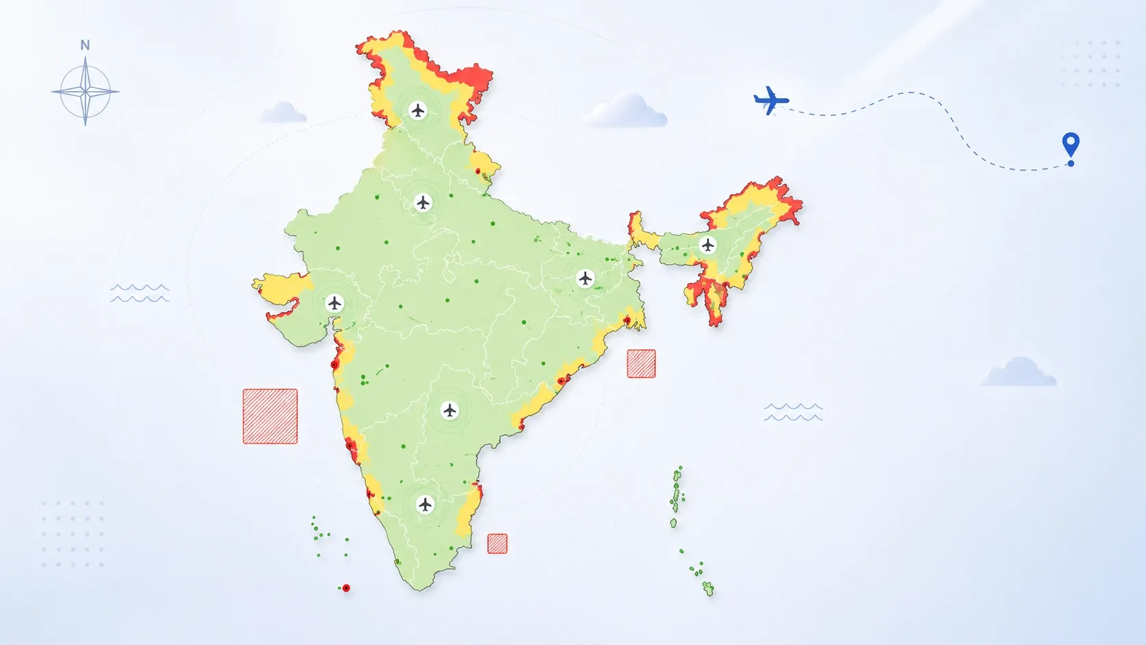
Reading the three operational zones
India's drone airspace structure uses three colour classifications under Rule 19 of the Drone Rules 2021. Each zone determines whether a drone may legally take off, what altitude restrictions apply, and whether additional approvals are required.
Zone | Permission requirement | Vertical limit | Operational status |
|---|---|---|---|
Green zone | No prior permission required | Up to 400 ft / 120 m AGL | Allowed |
Yellow zone | ATC or DigitalSky approval required | Above 400 ft in green zones; above 200 ft in 8–12 km airport buffer; above ground in 5–8 km buffer | Restricted |
Red zone | Central Government authorisation only | None — drone no fly zone | Prohibited |
Source: Drone Rules 2021, Rule 19 read with Rule 22.
Green zone operations
Green zones cover airspace where civilian drone operations can normally occur without prior approval. Under Rule 19 of the Drone Rules 2021, green zones extend from ground level to 400 feet (120 metres) AGL in areas not designated as red or yellow. The green zone also includes airspace from ground level up to 200 feet (60 metres) AGL. This applies to the area between 8 and 12 kilometres from the perimeter of an operational airport.
Operators in green zones do not need DGCA permission to fly drones with an all-up weight up to 500 kilograms. However, green zones are not permanent. Temporary restrictions may still apply because of NOTAM activity, VVIP movement, defence exercises, election security, or major public events declared under Rule 24(2).
Operators often treat green zones as unrestricted airspace. The classification only removes prior permission requirements. Operators must still comply with visibility rules, payload restrictions, local law enforcement directions, and NPNT requirements where applicable.
Yellow zone restrictions
Yellow zones cover controlled airspace requiring coordination with aviation authorities. These zones appear near airports, airbases, controlled corridors, and dense urban regions.
The most misunderstood aspect of yellow zones is vertical segmentation. The Drone Rules 2021 define the yellow zone vertically. It covers airspace above 400 feet in a designated green zone, and above 200 feet in the area between 8 and 12 kilometres from an airport perimeter. It also covers airspace above ground in the area between 5 and 8 kilometres from an airport perimeter. Yellow zone permissions must come from the concerned air traffic control authority. Depending on the airspace, this may be the Airports Authority of India, the Indian Air Force, the Indian Navy, or Hindustan Aeronautics Limited.
DigitalSky displays altitude-specific restrictions when operators inspect the layer interface on the airspace map.
Red zone prohibitions
Red zones prohibit civilian drone operations unless explicitly authorised by the Central Government. These areas include:
- International borders
- Military installations
- Strategic infrastructure
- Certain government complexes
- Nuclear facilities
- Sensitive national security locations
Locations around the India–Pakistan border, parts of Jammu and Kashmir, strategic defence corridors, and critical infrastructure networks remain permanently restricted.
Some historical monuments and protected national assets also carry operational restrictions. The Taj Mahal, for example, is governed by Archaeological Survey of India notifications that prohibit drone overflight without specific permission.
How to check a drone zone in India: step-by-step
The DigitalSky airspace map functions as a live operational compliance system rather than a static reference graphic. Operators should verify every mission location immediately before deployment because temporary restrictions may appear with little advance notice under Rule 24(2) of the Drone Rules 2021.
The verification process usually follows seven steps.
- Open the DigitalSky airspace map at digitalsky.dgca.gov.in/airspace-map.
- Allow browser location access or manually enter coordinates.
- Identify the colour overlay covering the operational area.
- Inspect altitude-specific restrictions on the layer interface.
- Review nearby airport or heliport buffers for the 5 km, 8 km, and 12 km rings.
- Check for active NOTAM overlays and Rule 24(2) temporary red zones.
- Save a screenshot for operational records.
The fourth step is where many violations occur. Operators verify the map at ground level but fail to inspect vertical restrictions. Around airports, lower-altitude operations may remain permitted while higher altitudes require ATC approval.
DigitalSky overlays may reflect temporary flight restrictions tied to active NOTAMs, but coverage is not always complete. The Airports Authority of India separately publishes NOTAM advisories at aim-india.aai.aero that may affect drone operations. Operators conducting commercial flights near controlled airspace should cross-check both systems before launch.
For mobile field use, third-party apps like AirMap overlay similar zone information on satellite maps. AirMap data should be cross-verified against DigitalSky because the official platform reflects the latest temporary restrictions. The geofencing built into NPNT-compliant drones will also block takeoff inside red zones, but operators cannot rely on geofencing alone for zone verification.
Commercial operators now integrate DigitalSky screenshots into pre-flight documentation because enforcement agencies often request proof that airspace verification occurred before takeoff.
Managing stacked airspace restrictions
One of the least understood features of India's drone framework is stacked airspace. The same physical location may fall under different operational categories depending on altitude.
Under Rule 19 of the Drone Rules 2021, the airport perimeter creates layered operational rings.
Airport distance | Vertical band | Zone classification |
|---|---|---|
5 km to 8 km | Above ground | Yellow zone |
8 km to 12 km | 0 to 200 ft AGL | Green zone |
8 km to 12 km | Above 200 ft AGL | Yellow zone |
Designated green zone | Above 400 ft AGL | Yellow zone |
Source: Drone Rules 2021, Rule 19 read with Rule 22.
Areas inside 5 kilometres of an airport perimeter are governed separately. Many of these zones operate as red zones under DGCA notifications and require Central Government authorisation. The precise boundary is airport-specific and depends on operational airspace classification.
This layered structure exists because aviation risk changes with altitude. A low-altitude inspection flight near an airport perimeter creates different risks compared to a higher-altitude operation intersecting controlled aircraft approach paths.
Delhi NCR demonstrates this complexity clearly. Some areas within the broader NCR region appear operationally open at lower altitude levels. They remain restricted above defined thresholds because of Indira Gandhi International Airport airspace protection rules.
Operators who only review the colour overlay without inspecting altitude layers misunderstand their legal operating limits. The same principle applies near heliports, defence aviation corridors, and emergency response routes.

Temporary restrictions and NOTAM overlays
India's drone airspace map changes regularly because temporary restrictions can be activated for security operations and public events. Rule 24(2) of the Drone Rules 2021 grants temporary red zone power to State governments, Union Territory administrations, and law enforcement agencies. They can declare a specified area a temporary red zone for a period not exceeding 96 hours.
These temporary overlays often create operational disruption for commercial operators working in media coverage, infrastructure inspection, surveying, or logistics.
In recent years, temporary red zones have been declared during:
- Republic Day security deployments
- Independence Day events
- G20 summit operations
- Election security management
- Major cricket events at venues like the Narendra Modi Stadium
- VVIP movement, including multiple PM visits to Srinagar declared under Rule 24(2)
- Religious gatherings with elevated security posture
The Narendra Modi Stadium region in Ahmedabad and central Delhi during G20 operations have both seen drone restrictions. The Nagaland Legislative Assembly Secretariat Complex in Kohima was declared a temporary red zone during the August 2024 session. Srinagar was declared a temporary red zone ahead of multiple PM visits in 2024 and 2025 (multiple State Police notifications, 2024–2025).
Temporary red zones often generate enforcement actions because operators rely on outdated screenshots or fail to recheck the map before deployment.
DigitalSky overlays may reflect temporary restrictions, but operators conducting high-value commercial missions also monitor Airports Authority of India NOTAM publications independently. The operational lesson is simple: yesterday's clearance does not guarantee today's clearance.
Common Indian locations and their typical zone classification
The questions operators ask most often involve specific locations. The list below covers high-search-volume queries and indicates the typical zone — but every operator must verify the live status on DigitalSky before each flight.
- Marine Drive, Mumbai — typically yellow zone because of proximity to Mumbai International Airport airspace; verify on DigitalSky.
- Cubbon Park, Bangalore — typically yellow zone because of proximity to HAL Airport and Kempegowda International Airport airspace; verify on DigitalSky.
- Goa beaches — varies by stretch; coastal areas near Dabolim Airport are yellow or red, while northern beaches further from airport perimeters often fall in green zone; verify on DigitalSky.
- Taj Mahal, Agra — red zone under ASI notifications; drone overflight prohibited without specific permission.
- Cubbon Park, Bangalore and Lalbagh — typically yellow zone; verify on DigitalSky.
- Delhi NCR, including Gurgaon and Noida edges — substantially yellow zone because of IGI Airport ring; central Delhi often shifts to red during VVIP movement; verify on DigitalSky.
- Border districts in Punjab, Rajasthan, and the Northeast — permanent red zone under national security notifications.
- ISRO Sriharikota and other strategic facilities — red zone; civilian drone operations prohibited.
Zone classifications change. Verify the current status on DigitalSky before every flight regardless of how recently the location was checked.
What this means for operators
India's airspace compliance model now depends on digital verification before every flight. The operational burden has shifted from manual paperwork toward live airspace awareness.
For recreational operators, the drone airspace zone map determines whether a location is legally flyable. For commercial operators, it directly affects insurance validity under Rule 44 of the Drone Rules 2021, contract compliance, and enforcement exposure.
The biggest operational change after 3 July 2025 is the separation between administrative workflows and airspace workflows. Registration, type certification, and Remote Pilot Certificates now occur through eGCA, but operational permission management still depends on DigitalSky.
That distinction matters because operators sometimes assume registration approval automatically validates airspace legality. It does not. A drone with a valid UIN issued through eGCA can still violate Rule 19 if launched in a yellow or red zone without DigitalSky permission.
The next phase of India's drone ecosystem will likely involve more dynamic restrictions and tighter integration between NPNT systems and live airspace feeds. Enforcement visibility near urban infrastructure corridors will also strengthen. The draft Civil Drone (Promotion and Regulation) Bill 2025, which entered public consultation on 16 September 2025, signals further enforcement integration in the period ahead.
India's drone ecosystem will depend less on broad permission categories and more on real-time operational compliance verified before every takeoff against the DGCA airspace map.