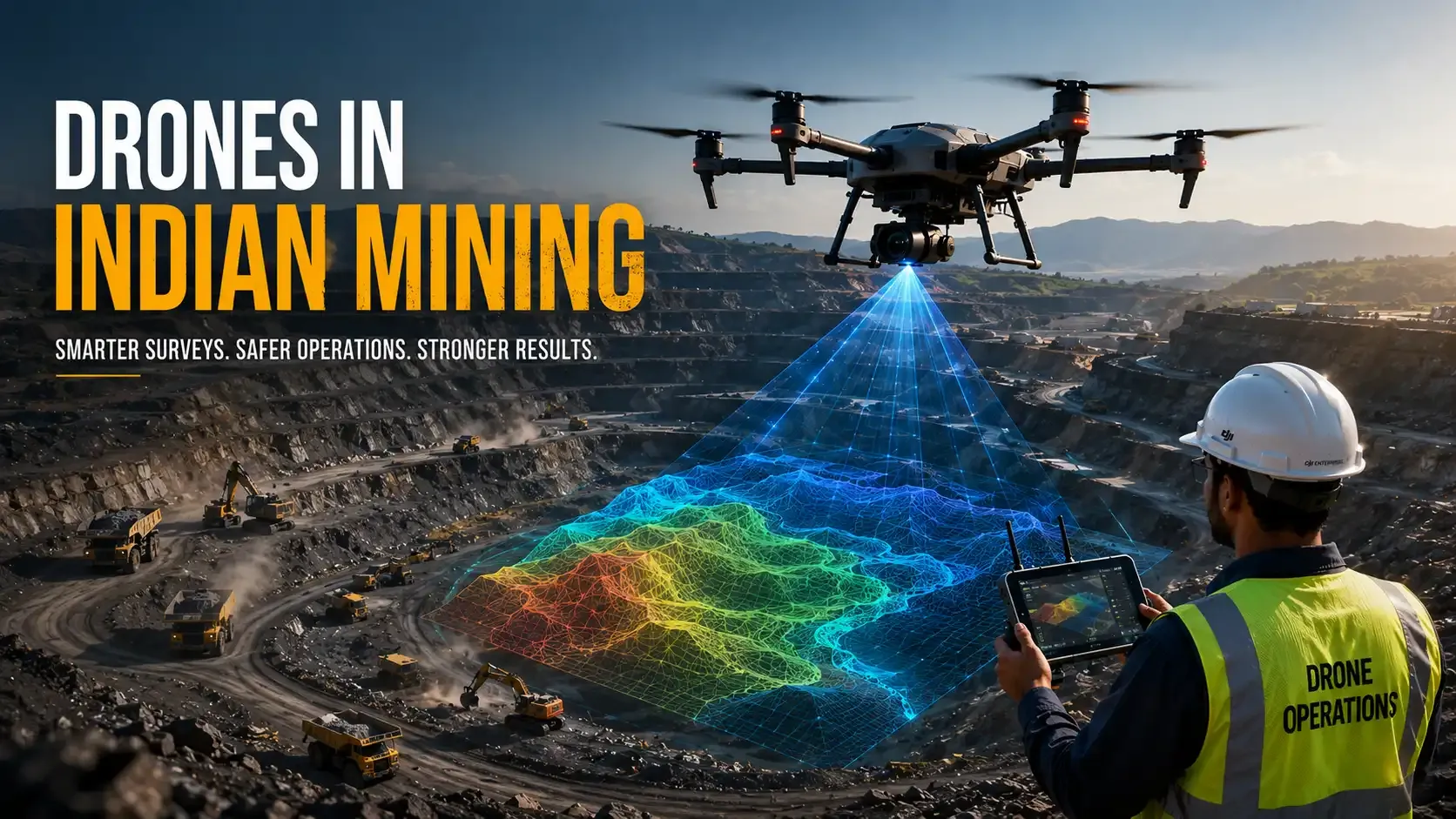
By November 2024, 1,349 mining leases had submitted drone data through the Drone Data Management System portal (Ministry of Mines Year End Review 2024). The figure marks how drones in Indian mining shifted from operator choice to regulator-tracked submission.
The Indian Bureau of Mines owns the Rule 34A survey deliverable. The Directorate General of Mines Safety governs in-pit safety under the Mines Act 1952. The Directorate General of Civil Aviation controls airspace under the Drone Rules, 2021.
Reading Rule 34A as a statutory deliverable
Rule 34A transformed drones in Indian mining from procurement options into regulated reporting infrastructure. The Mineral Conservation and Development (Amendment) Rules, 2021 inserted the rule on 3 November 2021 (Ministry of Mines, 3 November 2021). The amendment made annual drone surveys mandatory for every mining lease at or above 50 hectares. It also covers any lease with an excavation plan of 1 million tonnes a year.
The compliance obligation is not the flight itself. The obligation is the accepted survey deliverable. Rule 34A requires lessees to conduct drone surveys during April or May. They must then submit processed outputs before 1 July each year through the IBM-defined workflow (Ministry of Mines, 3 November 2021).
That distinction explains why service-provider marketing pages misread the regulation. Flying a drone is not the regulated act; submitting accepted orthomosaics, digital elevation models, and volumetric outputs is.
The Ministry of Mines clarified the accepted methods in November 2021. Drone surveys, Differential Global Positioning System measurements, and total-station surveys became valid submission mechanisms (PIB, 11 November 2021). The amendment removed the earlier CARTOSAT-2 LISS-IV requirement.
IBM later issued the operational Standard Operating Procedure under sub-rule (5) of Rule 34A. The SOP authorises the regulator to define submission formats and alternate workflows when drone operations face restrictions under another law. The threshold question now drives procurement decisions across the sector. Operators asking whether drone survey is mandatory for mining in India are effectively asking whether their lease crosses the 50-hectare or 1 million-tonne trigger.
Mapping the IBM jurisdiction
The Indian Bureau of Mines governs drone-survey compliance for non-coal mineral leases under the Mineral Conservation and Development Rules, 2017. Its jurisdiction excludes coal, petroleum, natural gas, atomic minerals, and minor minerals (Ministry of Mines Annual Reports, accessed 23 May 2026). Those categories are administered through separate statutory frameworks.
The IBM submission chain therefore applies only to the mineral categories falling under its regulatory authority. The confusion starts when IBM guidance gets incorrectly extended to coal-sector workflows. IBM does not regulate every mining drone operation in India. It regulates a defined class of mineral leases.
The regulator's operational focus is data integrity. IBM evaluates whether the submitted survey accurately represents pit geometry, excavation progression, benches, dump positions, and volumetric calculations under Rule 34A. The compliance question is therefore different from the DGCA airspace question. IBM does not grant flight permission; IBM evaluates the survey deliverable.
The Ministry of Mines reported 617 mining leases had already submitted Rule 34A data by November 2022 (PIB, 26 December 2022). That was two years before the 1,349-lease figure surfaced in the 2024 Year End Review. The acceleration shows how the Drone Data Management System has shifted from pilot-stage enforcement into nationwide compliance tracking.
Drawing the DGMS safety perimeter
The Directorate General of Mines Safety governs operational safety inside mining environments under the Mines Act 1952 (DGMS Statutory Framework, accessed 23 May 2026). DGMS also administers the Coal Mines Regulations 2017, the Metalliferous Mines Regulations 1961, and the Oil Mines Regulations 2017. Its oversight applies even when the drone survey itself exists for IBM compliance purposes.
The DGMS layer is operational, not cartographic. The regulator evaluates whether the drone deployment introduces risk to personnel, blasting schedules, haul-road operations, or active excavation zones. This is the difference between DGMS and IBM drone rules. IBM validates the survey submission; DGMS governs how the operation is conducted inside the mine.
An open-cast mine is an active industrial environment with moving machinery, blasting sequences, unstable benches, and restricted operational corridors. A compliant airspace authorisation from DGCA does not satisfy DGMS safety obligations inside the pit. The regulators operate on parallel tracks.
Coal operations add complexity because DGMS oversight intersects with sector-specific operational controls. Underground ventilation systems, explosive handling protocols, and hazardous-zone restrictions create tighter operational envelopes for unmanned systems.
Locating DGCA airspace authority
The Directorate General of Civil Aviation governs civil drone operations through the Drone Rules, 2021 (Ministry of Civil Aviation, 25 August 2021). Every mining survey flight must comply with airspace, registration, and permission requirements under the national drone regime.
DGCA jurisdiction applies regardless of the mine's ownership structure or regulatory category. A mining lease inside the IBM chain requires the operator to satisfy Type Certification, Unique Identification Number registration, Remote Pilot Certificate requirements, and NPNT compliance where applicable. The airspace map for India sets the perimeter for every takeoff, including over mine sites that border yellow or red zones.
The Bharatiya Vayuyan Adhiniyam 2024 replaced the Aircraft Act 1934 and now forms the statutory aviation base beneath the Drone Rules framework. Mining operators work near controlled or semi-restricted airspace zones tied to industrial corridors, energy infrastructure, and transport networks.
The question of who regulates drone use in Indian mines therefore has three simultaneous answers. IBM governs survey submission. DGMS governs operational safety inside the mine. DGCA governs the aircraft inside Indian airspace; survey-grade drones at mine sites also have to hold valid QCI type certification.
Tracing the coal-mine track through CMPDI
Coal-sector drone operations follow a different institutional pathway. The Central Mine Planning and Design Institute operates as the implementing agency for multiple Coal India survey programmes. In April 2021, the Ministry of Civil Aviation granted CMPDI conditional exemption for UAV-based coalfield surveys (PIB, 9 April 2021). The exemption covered optical, LiDAR, and thermal payloads across Coal India assets.
The exemption showed coal operations were already moving toward integrated unmanned surveying before Rule 34A entered force later that year. Coal-sector deployments operate under a heavier operational framework. They intersect with DGMS safety oversight, coalfield operational procedures, and ministry-level coordination.
Coal mine drone survey workflows differ from non-coal IBM submissions because the operating objective extends beyond annual volumetric reporting. Coal operators use unmanned systems for overburden analysis, thermal anomaly identification, haul-road planning, and excavation monitoring.
The coal track accelerated LiDAR adoption inside Indian mining surveys. Optical payloads handle routine volumetric calculations; LiDAR-based terrain mapping outperforms them in dust-heavy or low-contrast environments where photogrammetric reconstruction loses fidelity.
Submitting outputs through DDMS
The Drone Data Management System functions as the submission backbone for Rule 34A compliance. The portal standardises how mining lessees upload orthomosaics, digital elevation models, volumetric calculations, and associated survey metadata for IBM review.
The annual drone survey IBM submission deadline remains fixed around the 1 July reporting window established under Rule 34A (Ministry of Mines, 3 November 2021). The timing compresses the operational cycle because surveys must occur during April and May. That leaves a narrow processing and validation window before submission.
The portal also connects to a broader enforcement architecture. The Ministry of Mines operates the Mining Surveillance System, a satellite-based illegal mining detection platform. MSS recorded 138 triggers during phase four in 2022-23 and 157 triggers in 2023-24 (Ministry of Mines Year End Review 2024). DDMS and MSS together create a dual-layer oversight system.
That integration changes the audit profile for mining operators. A missing submission is no longer an isolated paperwork issue. It becomes visible inside a linked digital monitoring chain where volumetric records, satellite observations, and lease activity get cross-checked against each other.
Layering AI into the mining-drone workflow
The mining-survey stack is becoming progressively machine-assisted while the legal responsibility remains human-administered. AI changes the operational layer behind the Rule 34A deliverable; it does not change the regulator who signs off on it.
Modern survey pipelines use computer-vision models to classify stockpile edges, identify haul-road geometry, and automate terrain reconstruction from overlapping imagery. AI-assisted photogrammetry compresses the gap between flight capture and a submission-grade volumetric output. That compression matters when the April-to-July compliance window leaves little room for manual rework.
Mission-planning software is absorbing site complexity through route-planning algorithms and automated terrain-following capability. Edge inference systems identify obstacle density, classify machinery movement, and recommend flight corridors before launch. The regulatory responsibility rests with the operator, but AI-assisted planning is part of the industrial survey stack.
Computer-vision systems also improve the speed of submission validation. Automated terrain comparison, change-detection analysis, and anomaly identification reduce manual review time across high-volume datasets. The same models that compress submission timelines also raise the bar on what an acceptable survey looks like.
The legal architecture has not shifted with the technology. IBM evaluates the survey deliverable. DGMS governs in-pit safety. DGCA owns the airspace decision.
AI shortens the path; the three-regulator chain defines the destination.
Holding the survey to IBM standards
IBM acceptance depends on survey quality, overlap integrity, and processing accuracy rather than drone ownership alone. Volumetric survey mining India workflows require repeatable data-capture standards because annual submissions must remain comparable between reporting cycles.
The IBM Standard Operating Procedure defines technical expectations around image overlap, georeferencing quality, ground-control integration, and processed terrain outputs (Ministry of Mines, 3 November 2021). Operators asking about drone survey accuracy requirement mining India are effectively asking whether the final terrain model can withstand regulatory review.
Low-overlap imagery creates reconstruction gaps. Weak ground-control workflows distort elevation models. Inconsistent geotagging breaks longitudinal comparison between annual surveys. The regulator evaluates the integrity of the processed output, not the marketing specifications attached to the aircraft.
Mining operators are shifting toward integrated survey pipelines that combine flight automation, AI-assisted photogrammetry, and standardised quality assurance. The operational consequence is straightforward: mining drone surveys are becoming data-engineering workflows rather than isolated aerial-imaging projects. Third-party drone insurance for mining operators is being underwritten with the same dataset discipline in mind.
Building an operator decision tree for the threshold
The Indian mining drone market is consolidating around compliance-grade operations rather than generic aerial surveying. Lessees crossing the Rule 34A threshold need an annual workflow that satisfies IBM submission standards, DGMS operational requirements, and DGCA airspace obligations.
The decision tree starts with jurisdiction. Non-coal mineral leases move through IBM submission workflows. Coal-sector operations move through CMPDI-linked structures.
The next layer is airspace and registration compliance under the Drone Rules, 2021. The final layer is site-level operational safety under the Mines Act regime.
The enforcement environment is also tightening. The Ministry of Mines tracks submissions through DDMS and cross-validates mining activity through the Mining Surveillance System (Ministry of Mines Year End Review 2024). Operators outside the reporting chain are becoming easier to identify.
The procurement market is changing alongside the regulation. Buyers no longer evaluate only flight capability. They evaluate submission acceptance rates, geospatial processing quality, pilot certification status, airspace workflow discipline, and data reproducibility between reporting cycles.
The next twelve months will pull more mineral lessees into the DDMS cycle. Integration between DDMS and the Mining Surveillance System will tighten. Procurement teams will face a sharper question on every survey contract. The operational divide inside Indian mining will sit between operators running regulator-aligned, AI-assisted survey infrastructure and operators still treating compliance as a one-time aerial service purchase.
Kodainya is building toward autonomous survey and mission-processing stacks that compress the gap between flight capture, terrain intelligence, and regulator-grade submission workflows for India's industrial environments.
