The Parliamentary Standing Committee on Defence reviewed programmes at the Naval Science and Technological Laboratory in Visakhapatnam (Parliamentary Standing Committee on Defence, 20 January 2026). The visit confirmed a shift in the Indian Navy's modernisation effort.
Unmanned maritime systems in India are no longer standalone technology projects. They are entering force-structure planning. The clearest way to read that transition is a surface-subsurface-seabed framework, which maps platforms, missions, and the labs and shipyards behind them.
Mapping the three layers of the maritime autonomy stack
Unmanned maritime systems in India rest on three connected operational layers. Surface vessels work on the water, underwater vehicles work below it, and sensor networks sit on or near the seabed. Each layer answers a different problem, and the architecture earns its value when the three operate as one.
Surface vessels extend maritime presence without committing crewed ships to routine patrol. Autonomous underwater vehicles gather intelligence, inspect infrastructure, and hunt mines in contested water. Seabed sensing holds position for long periods, watching for vessels, submarines, and activity that mobile platforms miss between sorties.
The layers reinforce one another in practice. A surface vessel can carry and launch an underwater vehicle. An underwater vehicle can relay data from a seabed sensor, and a shore station can fuse all three feeds into a single picture.
This differs from the older pattern, where each ship carried its own sensors and ran its mission alone. The autonomy stack instead spreads sensing, communications, and decision-making across a distributed set of uncrewed assets. The shift changes how a commander builds an operating picture.
Understanding the difference between platform classes matters here. It mirrors the air domain, where the difference between a UAV, a UAS, and an RPAS shapes how a system is regulated and tasked. The maritime stack borrows that logic and applies it across the water column rather than the sky.
Reading the roadmap behind India's push at sea
The Indian Navy unmanned roadmap is built around persistence. The aim is to hold surveillance and awareness across wide maritime areas without leaning only on costly crewed platforms.
India's maritime responsibilities run along a long mainland-and-island coastline and a wide Exclusive Economic Zone. Watching that space without gaps demands more sensors and hulls than a conventional fleet can field economically. Uncrewed platforms close the arithmetic.
The Integrated Unmanned Roadmap sets the framework for expanding these capabilities across the years ahead (Indian Navy, Integrated Unmanned Roadmap). It treats uncrewed systems as enablers for surveillance, logistics, mine countermeasures, anti-submarine warfare, and maritime domain awareness. The Technology Perspective and Capability Roadmap reinforces that direction. It names autonomous and unmanned systems as a priority technology area for future force development (Ministry of Defence, Technology Perspective and Capability Roadmap).
The demand signal is visible in procurement planning. Naval leadership has indicated long-term interest in fielding hundreds of uncrewed platforms alongside conventional vessels. The discussed figure of around 400 unmanned surface vessels reflects the scale of ambition rather than a single tender (Indian Navy, Integrated Unmanned Roadmap).
The parliamentary review of the laboratory's programmes matters because oversight tends to follow capability maturation. A programme under sustained review is moving from research toward operational relevance. That is the signal builders should read.
This reframes the market. The opportunity is no longer vehicle production alone. It now spans sensors, autonomy software, communications, underwater navigation, mission planning, and data-fusion infrastructure. Teams positioning against the broader set of military drone programmes India runs will recognise the same indigenous build-up applied to the sea.
Patrolling coastlines with unmanned surface vessels
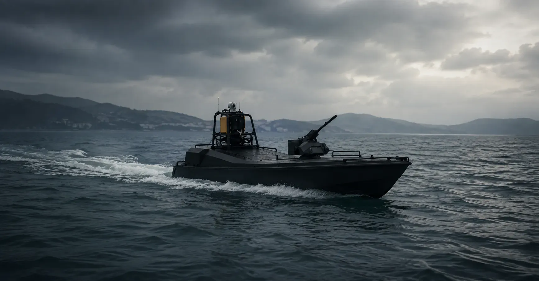
An unmanned surface vessel India programme extends surveillance reach across coastal waters, ports, naval bases, and offshore infrastructure. The aim is continuous presence where a crewed patrol craft would be costly to sustain around the clock.
The clearest example is Jaldoot. It was developed jointly by the Naval Science and Technological Laboratory and Garden Reach Shipbuilders and Engineers. The vessel completed acceptance trials before its handover for evaluation and mission development (GRSE, 5 December 2024).
Jaldoot supports waypoint navigation, station-keeping, and fail-safe behaviour on a rechargeable battery. It shows how unmanned surface vessels for Indian Navy missions can run survey and communication tasks without placing sailors aboard. Such platforms patrol set routes, monitor activity, and relay data to shore stations or command ships.
Surface vessels hold a useful position in the autonomy stack. They carry larger payloads and keep a reliable link. Unlike underwater vehicles, they stay connected to satellite and radio networks for the length of a sortie, which lets them act as relays for the layers below.
Autonomy contributes through route optimisation, collision avoidance, sensor management, and anomaly detection. That frees personnel to focus on decisions rather than routine helm work. A standard hull and a modular payload bay keep unit cost down across a large fleet. It also lets one operator oversee multiple hulls at once.
The reported target of Indian Navy 400 unmanned surface vessels points to distributed surveillance networks across priority maritime areas. Shore hubs would rotate vessels in and out of patrol zones to close coverage gaps. For coastal agencies and the Indian Coast Guard, these vessels widen coverage at low cost (Indian Coast Guard, underwater and surface drone adoption). Shipborne launch and recovery draw on the same deck-handling know-how that governs vertical take-off platforms at sea.
Diving deep with autonomous underwater vehicles
An autonomous underwater vehicle India programme operates where communications thin out and human access is hard. Unlike a surface vessel, the vehicle cannot rely on continuous satellite contact. It leans instead on inertial navigation, sonar-based localisation, mission-planning software, and onboard decision support.
India's reference point in this class is Neerakshi. It is a compact vehicle of roughly two metres and around 45 kilograms, built by Garden Reach Shipbuilders and Engineers with an industry partner (GRSE, 28 July 2023). It is rated to an operating depth near 300 metres and accepts swappable payloads tied to the role.
As an autonomous underwater vehicle for mine detection, it carries a direct operational logic. Naval mines are among the cheapest threats to lay and the costliest to clear. Sending an uncrewed system into mined water lowers the risk to sailors and high-value ships.
A vehicle of this type can carry side-scan sonar, imaging sonar, environmental sensors, and mapping equipment. Those payloads help operators identify mines, inspect underwater infrastructure, and survey seabed conditions. Onboard software classifies sonar contacts and flags the objects that warrant human review, trimming the manual analysis a long survey would demand. An endurance class measured in hours suits harbour and coastal survey, with longer-ranged variants under development.
The undersea environment sets the hardest constraints. Acoustic links are slow, and satellite positioning does not reach below the surface. Conditions also change with depth and water column. An underwater vehicle therefore needs more onboard judgement than a surface craft, and that requirement shapes how each platform is designed.
Extending endurance with large subsurface platforms
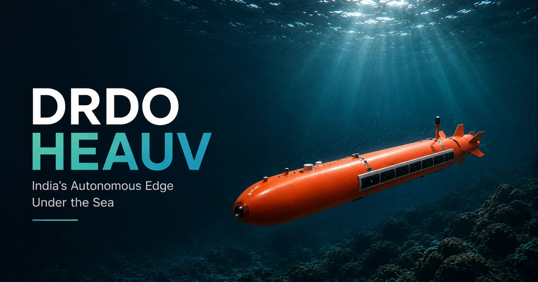
An unmanned underwater vehicle India capability runs past compact survey craft into larger, endurance-led platforms. The High Endurance Autonomous Underwater Vehicle, known as HEAUV, marks that effort. It completed a surface run followed by lake trials, which demonstrated its dynamics and sonar performance (DRDO, March 2025).
The high endurance autonomous underwater vehicle India concept answers a hard operational limit. Smaller vehicles are bound by battery capacity and short mission windows. A larger hull offers longer endurance, more payload, and wider reach.
The trials class points to a vehicle near ten metres long and one metre in diameter. It is built around an endurance of up to fifteen days at low speed, with swappable payload modules. That order of persistence is what open-ocean tasks demand.
A cruise near three knots stretches the deployment, and a higher dash speed closes on a contact. The depth rating near 300 metres keeps the vehicle within the band where much survey work sits.
These platforms support intelligence collection, seabed mapping, anti-submarine surveillance, and infrastructure monitoring. Endurance becomes the deciding factor across the long distances of the Indian Ocean Region, where a short-duration vehicle cannot cover useful ground.
A large uncrewed vehicle sits between a compact survey vehicle and a crewed submarine. It does not replace the submarine, because it lacks the same flexibility and payload. It complements one by holding a sensing or monitoring task for days at a time.
Mission autonomy grows in weight as endurance extends. A vehicle out for days or weeks needs route planning, energy management, obstacle avoidance, and sensor prioritisation that hold up without an operator in the loop. The move toward larger platforms signals an intent to build sustained undersea presence. It also positions the larger hulls as carriers for the heavier sensor fits that seabed and anti-submarine work require.
Hunting mines and detecting submarines below the waterline
A mine countermeasures drone and anti-submarine warfare unmanned platforms address two of the hardest naval missions. Mine warfare is a persistent problem. Mines can disrupt shipping, delay operations, and threaten port infrastructure, while conventional clearance exposes both people and ships to risk. A single moored mine can close a harbour mouth until a team clears it.
The Naval Science and Technological Laboratory has worked on a man-portable autonomous underwater vehicle for mine countermeasure missions. Field trials validated autonomous navigation, target detection, communication stability, and mission endurance (NSTL, field trials).
The man-portable autonomous underwater vehicle category adds flexibility. A small team can transport and deploy the systems without a specialised support vessel, which suits harbour approaches and shallow water. Across the wider mission set, naval mine countermeasures India programmes will lean on these portable systems for close-in survey that larger platforms cannot reach.
Anti-submarine warfare poses a different challenge. Detecting a submarine demands persistent sensing across a wide area, and no single platform can hold that coverage alone. This is where uncrewed systems complement traditional assets.
Surface vessels deploy and tow sensors. Underwater vehicles run searches. Seabed networks hold a persistent watch. Together they build a layered detection picture that a lone hull cannot.
Software supports the work by processing acoustic data and surfacing the contacts that need an analyst's eye. Confirmation and any engagement decision stay with the operator. The direction of travel ties these platforms into broader command-and-control rather than treating them as separate tools. The teaming logic that pairs strike assets in loitering munitions and the kamikaze drone class recurs here, with sensing and effect spread across crewed and uncrewed units.
Listening on the seabed for undersea domain awareness
Underwater domain awareness is the ability to detect, classify, track, and understand activity beneath the surface. Seabed surveillance India efforts focus on persistent sensing networks that watch strategic waters. Unlike a ship or a vehicle, a seabed system stays in place and collects without interruption.
A clear reference point is the Integrated Underwater Harbour Defence and Surveillance System at Port Blair. It detects and tracks surface and underwater threats around a strategic naval facility, combining sensors, processing, and command systems (ICWA, Underwater Domain Awareness study).
The seabed sensor network Indian Ocean concept scales that idea across wider geography. Fixed sensors hold continuous watch, while mobile uncrewed platforms investigate the contacts those sensors flag. Island territories and chokepoints are the natural anchor points for such a grid. Magnetic-anomaly detection and advances in quantum-grade sensing point to where the grid can grow.
The Naval Physical and Oceanographic Laboratory anchors the indigenous sonar work that feeds this layer. Programmes such as the Abhay sonar and the HUMSA-UG lineage build the signal-processing and acoustic foundation a seabed grid depends on (DRDO and NPOL, sonar programme references). Passive arrays listen quietly, while active systems range a contact when the situation allows.
The value of seabed sensing is persistence rather than mobility. A surface vessel may patrol for days, and an underwater vehicle may run for hours or weeks. A seabed sensor can stay deployed and listening over far longer spans.
The combination of seabed sensors, autonomous underwater vehicles, and surface vessels forms a layered underwater domain awareness architecture. That architecture supports the long-horizon goal of reading activity across the water column. It turns scattered detections into a maintained picture that an analyst and a commander can act on.
Teaming crewed ships with robotic escorts
Manned-unmanned teaming Indian Navy concepts pair crewed ships with distributed autonomous systems working around them. The model mirrors the air and land domains, where an uncrewed system extends the reach of a crewed platform rather than replacing it. Readers who have followed manned-unmanned teaming in the air domain will recognise the structure applied to the sea.
A crewed warship acts as the command node. Uncrewed surface vessels nearby run patrol legs. Autonomous underwater vehicles inspect underwater contacts, and seabed sensors contribute persistent feeds.
The arrangement widens coverage without a proportional rise in crew size. It spreads risk across multiple platforms instead of one hull. It also lets the crewed node stand off from the highest-threat water.
The approach depends on secure communications, mission autonomy, sensor fusion, and command systems that integrate diverse inputs. Bharat Electronics Limited and other public-sector technology houses supply the electronics and networking that hold the picture together. Work on multi-domain concepts is advancing too. The Naval Science and Technological Laboratory and Bharat Dynamics Limited are collaborating on an aquatic-aerial system designed to transition between air and water (DRDO, 3 January 2026).
The long-term objective is not a fleet of independent robotic ships. It is a coordinated force in which crewed and uncrewed assets support one another across the mission set, from patrol to mine hunting to anti-submarine search. Teaming is the connective tissue that lets the three layers act as one architecture.
Building the indigenous development spine
India's unmanned maritime ecosystem is built around laboratories, shipyards, public-sector enterprises, and operational users working in concert. A DRDO autonomous underwater vehicle effort sits at the centre of this spine. The research organisation drives the platforms, and the Navy shapes requirements as the primary user.
The Naval Science and Technological Laboratory leads work on underwater weapons, autonomous platforms, and maritime systems. The Naval Physical and Oceanographic Laboratory contributes sonar and underwater sensing expertise.
On the build side, Garden Reach Shipbuilders and Engineers, Cochin Shipyard Limited, and Mazagon Dock support platform construction and integration. Bharat Electronics Limited and Bharat Dynamics Limited add electronics, networking, and weapons development. This distributed structure mirrors the wider defence-industrial approach across naval modernisation, where each organisation specialises while feeding a shared capability goal.
The model opens room for smaller suppliers too. They support sensors, autonomy software, edge computing, navigation, underwater communications, power systems, and mission-management tools.
Software is becoming as decisive as hardware. Sensor fusion, route planning, acoustic classification, and mission management shape how well a platform performs in the water. Artificial intelligence enters the spine at exactly these points, anchored to specific programmes rather than added as a generic claim.
For procurement teams, the takeaway is that maritime autonomy is turning into an ecosystem requirement rather than a platform requirement. The reference points stay close to the air-domain taxonomy. Readers tracing how India classifies the main types of drones will see the same indigenous logic extended to the maritime fleet.
Confronting communications, power, and trust gaps
The hardest problems in maritime autonomy are not platform shape alone. Communications, power, and operational trust set the real limits. Each one shapes how fast a programme can move from trial to deployment.
Underwater communications stay slower and less reliable than surface links. Battery technology caps endurance, and autonomous navigation gets harder in a complex undersea environment. Analytical assessments from the Observer Research Foundation have flagged shortfalls in endurance and underwater sensing. They also note gaps in autonomous decision support relative to future needs (Observer Research Foundation, 6 September 2025).
These are engineering constraints with operational consequences. They explain why progress runs through staged trials rather than single leaps. Each trial buys a measure of confidence.
Trust matters as much as hardware. Operators must understand how an autonomous system behaves under degraded conditions. Reliability and predictability become operational requirements rather than design preferences. Building that confidence takes longer than building a prototype.
That is why field evaluation and operational experimentation sit at the centre of every programme described here. The next phase will concentrate on endurance, communications resilience, underwater navigation accuracy, and multi-platform integration. None of these is solved by a single vehicle. Each is solved by the architecture maturing as a whole, which is the test the roadmap now sets.
Securing the Indian Ocean with persistent networked vigilance
India's maritime autonomy strategy now centres on holding a persistent picture of activity across the water column rather than fielding individual platforms in isolation. Surface vessels extend reach above the water. Autonomous underwater vehicles work below it, and seabed sensors supply the persistence. Together they form the foundation of a distributed surveillance architecture aligned with the Indian Navy's long-term roadmap.
For defence integrators, procurement teams, and policymakers, the decisive question has shifted. It is no longer whether India can field unmanned maritime systems. It is whether those systems can be networked into one operational architecture that senses, classifies, and tracks activity across the Indian Ocean Region without interruption.
The next milestone to watch is not another vessel launch. It is the integration of surface, subsurface, and seabed systems into a single autonomous network that can persist across the Indian Ocean at scale. The teams that prepare now for that integration will set the pace for the layer that follows.